Tour Overview
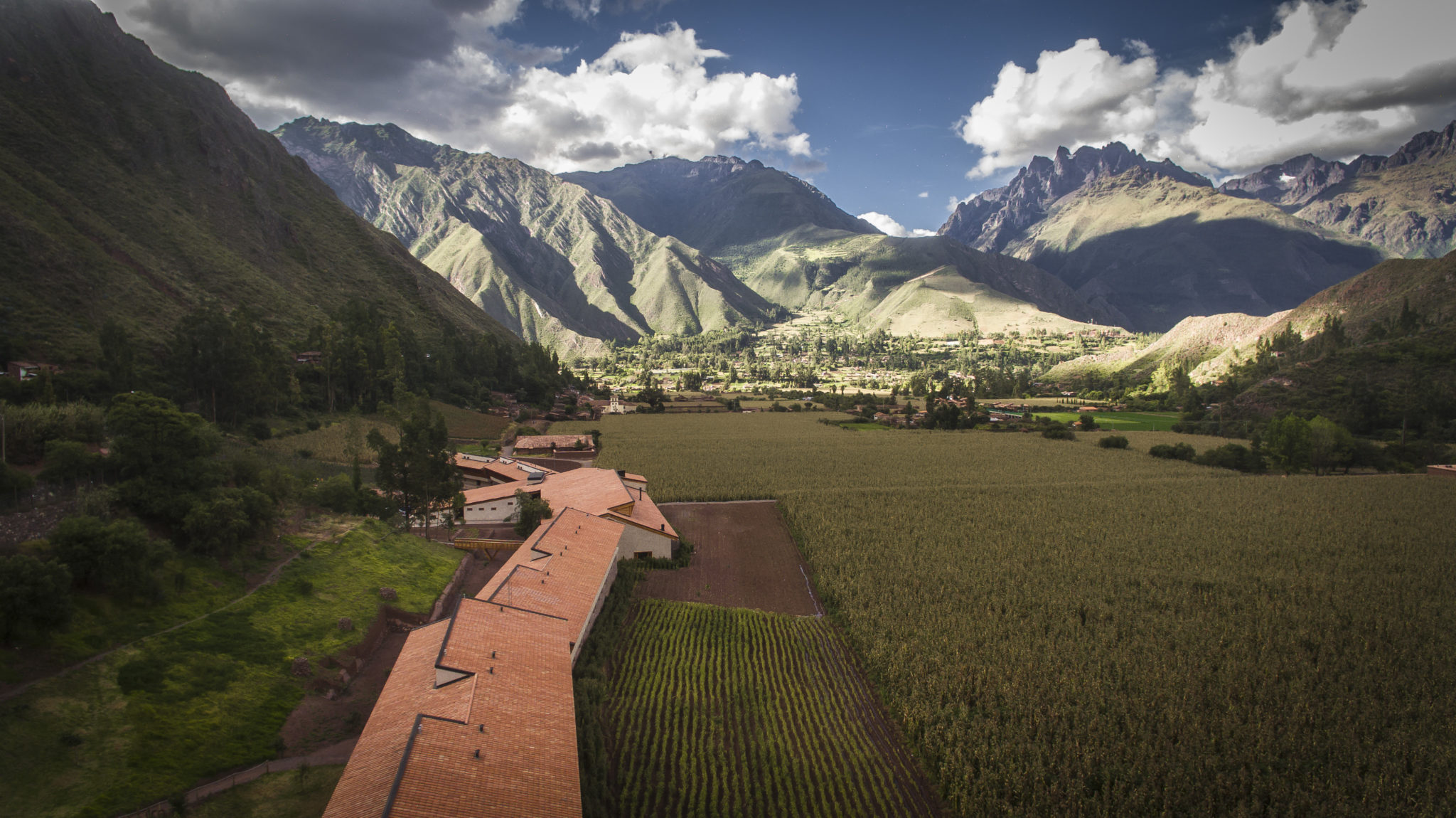
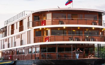
Explora Valle Sagrado was designed as a headquarter from where to explore a remote and great destination: Cusco, Machu Picchu and the Sacred Valley of the Incas. All our programs include accommodations, transfers, meals and beverages, and a selection of more than 30 explorations developed by our outdoor team.
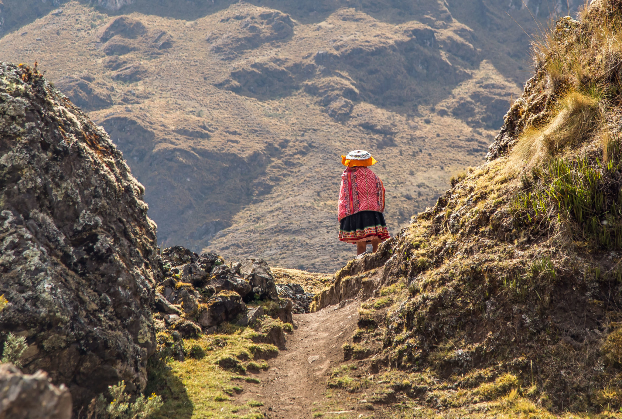
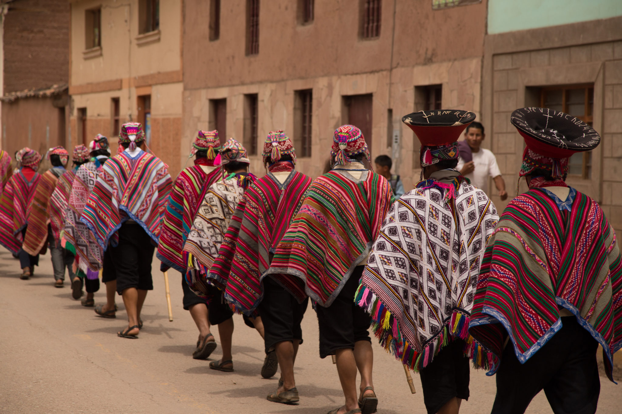
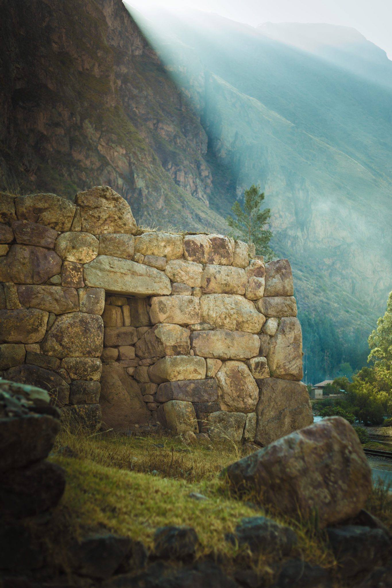
Our explorations take travelers through the colonial history of Cusco and the architectural magnificence of the Incas in Machu Picchu, isolated villages, archaeological sites such as Ollantaytambo, Moray, Chinchero and Pisac, to Andean pampas and mountains or Apus, considered by locals as guardians of people and nature.
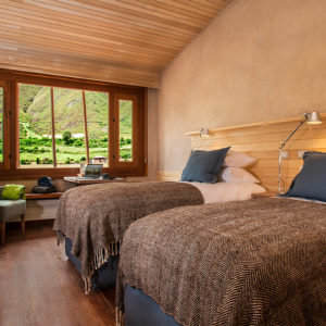
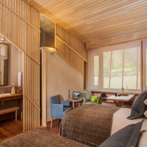
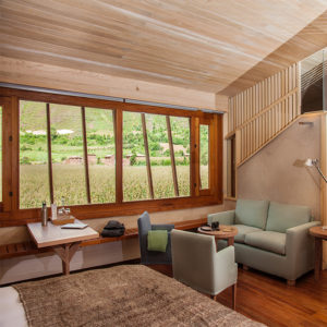
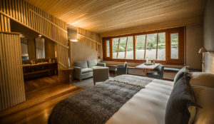
Room types
Explorations
Sacred Valley –located at the heart of the ancient Inca Empire–is a particular mix of natural and cultural beauty that has attracted explorers and travelers for hundreds of years. Its main attraction points –Cusco and Machu Picchu– are the gateway to a destination featuring overwhelming landscapes, local culture and history.
Machu Picchu
In this full-day expedition, we travel to the famous historical sanctuary of Machu Picchu, one of the most impressive architectural feats of the Inca civilization and a wonder of the world.
This version of the expedition to Machu Picchu takes place on Tuesdays, Thursdays, and Saturdays. It does not include the trek to Inti Punku.
The itinerary begins early in the morning towards the Ollantaytambo rail station, located 45 minutes away from explora, where we take the train to the town of Aguas Calientes. From there, we take a bus to Machu Picchu. We have about three hours to explore this magical site. Once we are done, we leave Machu Picchu to the station and take the train back. We return to the hotel for dinner.
We bring a light lunch to eat while we are there.
Additional cost apply for this tour – please contact us
Our exploration to Machu Picchu combines explora services with third-party services due to site restrictions. You must have confirmed this expedition with our reservation team at least 50 days prior to your stay. The schedules and duration times are estimated and may vary depending on the number of people on each route. *Subject to availability.
Difficulty level: Easy
Type: Full day
Duration: 12h
Max. Altitude: 2,500 m.a.s.l. / 8,202 f.a.s.l.
Cusco
This exploration shows the best of Cusco in one day. We will descend from the fortress of Saqsaywaman down crossing the alleys of the colonial quarter of San Blas to the main square. After lunch, the traveler can continue walking through Cusco with one of our guides or on his/her own. The temple of Corincancha, on which te Santo Domingo convent was built, Museum of Pre-Columbian Art, the San Pedro Market, some Art Galleries or the hundreds of souvenirs stores are some of the options we recommend.
*Tickets to the evening atractions are not included.
Difficulty level: Easy
Type: Full day
Duration: 10h
Max. Altitude: 3,700 m.a.s.l / 12,139 f.a.s.l
Valle de la Papa
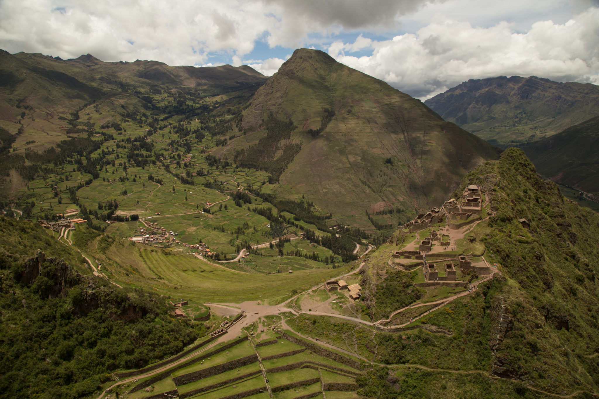
This exploration takes the traveler to one of the most fertile areas in the Sacred Valley. The journey begins towards the Quinsacocha lagoon, a sublime site that features the typical Cusco puna landscape. Going downhill, we will cross the el Valle de la Papa and next, visit the Quechua community of Chahuaytire, a place with an ancient textile tradition where we will learn about natural dying and back strap loom techniques. The trip ends with a visit to the stunning archaeological center of Pisaq, a city built on a mountain with hundreds of remarkable hanging farm terraces on its slopes.
Difficulty level: Easy
Type: Full day
Duration: 9h
Max. Altitude: 4,050 m.a.s.l / 13,287 f.a.s.l
Pirka
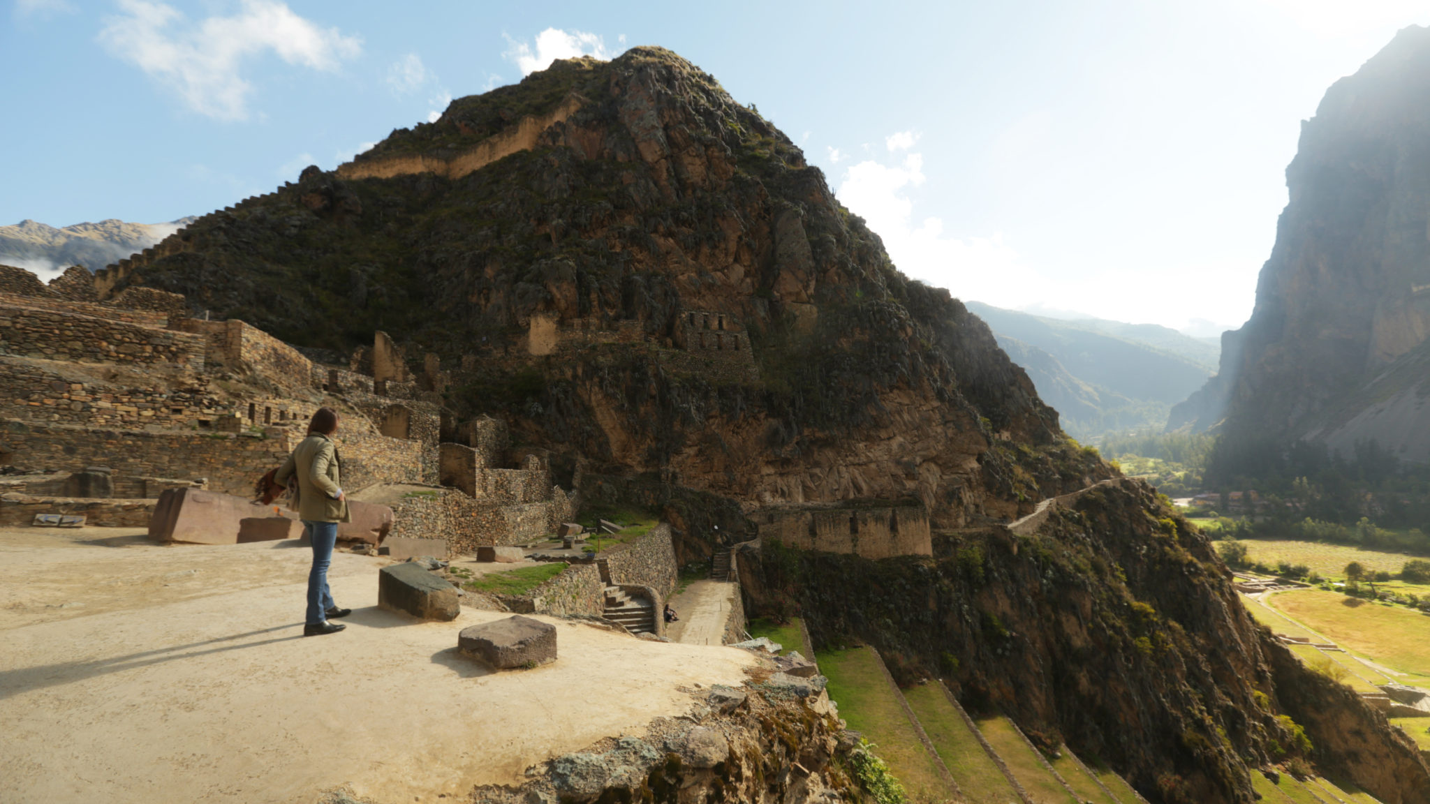
This route first takes us to Ollantaytambo, also known as the “living Inca city”. From there, we will travel to the archeological site of Moray, a laboratory of experimental farming where different microclimates are used to grow crops. From here we continue to Maras and a large lagoon, an ideal place to take a stroll and have lunch, to then follow to the town of Chinchero. The road crosses several fields where we will see farmers working or looking after their animals.
Difficulty level: Easy
Type: Full day
Duration: 10h 30 min
Max. Altitude: 3,860 m.a.s.l / 12,664 f.a.s.l
Valle Sur
This exploration reveals the influence of the Spanish conquest in the region, embedded in art and in the religious syncretism that resulted from the encounter of these cultures. We begin by touring the first of three Canincunca churches that we visit in this exploration. We then walk to the Huaro church and take a van to the Andahuaylillas church, where we tour the choir and the museum. Next, we hop on a van towards an Inca road, where we take a light trek to a wetland, perfect for bird watching and having lunch. Finally, we take the van to the Tipón archaeological center, a token of the Inca’s knowledge of fluid power. We return to explora by van.
Difficulty level: Easy
Type: Full day
Duration: 10h
Max. Altitude: 3.413 m.a.s.l. / 11.198 f.a.s.l.
Machu Picchu- Inti Punku
Difficulty Level: Moderate
In this full-day exploration, we travel to the famous historical sanctuary of Machu Picchu, one of the most impressive architectural feats of the Inca civilization and a wonder of the world.
On Mondays, Wednesdays, Fridays, and Sundays, we hike to the Sun Gate or Inti Punku, the gateway through which all the travelers that hike the Inca Trail enter. This point offers a different location from where to admire the sanctuary.
The itinerary begins early in the morning towards the Ollantaytambo rail station, located 45 minutes away from explora, where we take the train to the town of Aguas Calientes. From there, we take a bus to Machu Picchu. The entrance to the Sanctuary is scheduled at around midday. This is the starting point of the walk to Inti Punku or the Sun Gate, the ancient checkpoint to enter the citadel and the beginning of the Inca Trail from Machu Picchu. This 2 km (1.2 miles) upward hike at a leisurely pace is considered of medium difficulty. We strongly recommend taking the time to enjoy the privileged view offered by the Sun Gate. At the end of the hike, we begin touring the most renowned milestones in Machu Picchu.
We bring a light lunch to eat while we are there.
On Tuesdays, Thursdays and Saturdays, the exploration to Machu Picchu begins a bit later since it doesn’t include the walk to the Sun Gate or Inti Punku.
*Subject to availability. Our exploration to Machu Picchu combines explora services with third-party services due to site restrictions. You must have confirmed with our reservation team at least 50 days prior to the stay. The schedules and duration times are estimated and may vary depending on the number of people on each route.
Difficulty level: Moderate
Type: Full day
Distance: 5.4 km/ 3.4 miles
Max. Altitude: 2,660 m.a.s.l / 8,727 f.a.s.l
Elevation gain: 695 m / 2,280 ft
Elevation loss: – 698 m / – 2,290 ft
Moray
The trail begins at a farming community located amidst hills and goes down to the Inca remains of Moray, a laboratory of experimental farming where different microclimates are used to grow crops.
Difficulty level: Easy
Type: Half day
Duration: 2h 30 min
Distance: 3.2 km / 2 miles
Max. Altitude: 3,732 m.a.s.l. / 12,244 f.a.s.l.
Elevation gain: 76 m / 248 ft
Elevation loss: – 302 m / – 991 ft
Senderito de Pisaq
We descend from the mountains to the remains of Pisaq. We will use one of our alternative routes to access the back of the remains, which provides for a unique view. This exploration is recommended for every traveler wishing to enjoy an altitude landscape that calls for contemplation.
Difficulty level: Moderate
Type: Full day
Duration: 6h
Distance: 5.8 km / 3.6 miles
Max. Altitude: 3,871 m.a.s.l. / 12,700 f.a.s.l.
Elevation gain: 191 m / 627 ft
Elevation loss: – 1,013 m / – 3,324 ft
Ollantaytambo
The walk takes us through the living Inca town of Ollantaytambo. The trail passes through the old main gate and over cobblestone streets framed by narrow water channels. After visiting the village, we climb to the archaelogical site to see its terraces, the ceremonial center and the Royal Building.
Difficulty level: Easy
Type: Half day
Duration: 3h
Distance: 4.7 km / 2.9 miles
Max. Altitude: 2,885 m.a.s.l. / 9,465 f.a.s.l.
Elevation gain: 177 m / 581 ft
Elevation loss: – 146 m / – 479 ft
Salineras
Hiking begins visiting the colonial town of Maras. After crossing the village, the trail descends among potato fields to the community’s salt mines.
*Not recommended for travelers with fear of heights.
Difficulty level: Moderate
Type: Half day
Duration: 2h 45 min
Distance: 6.5 km / 4 miles
Max. Altitude: 3,371 m.a.s.l. / 11,059 f.a.s.l.
Elevation gain: 162 m / 532 ft
Elevation loss: – 681 m / – 2,234 ft
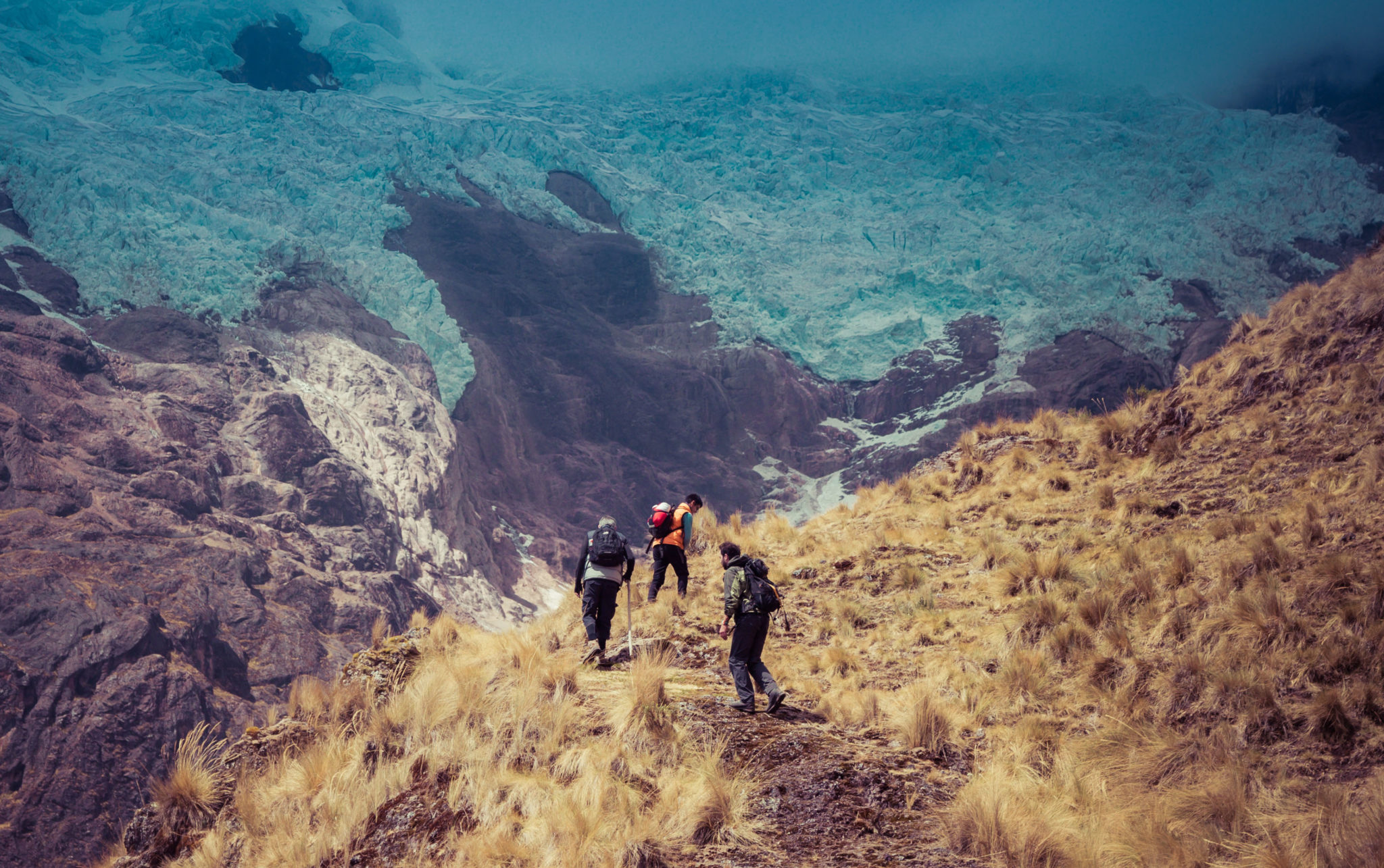
5 Lagunas
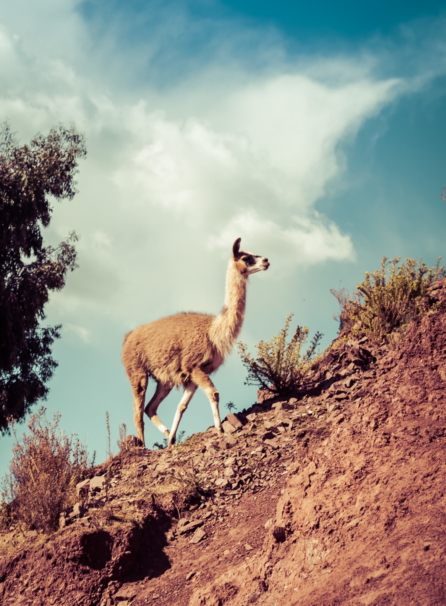
This walk begins at an isolated community in the heights of the Andes. From there, the trail goes up to a broad pass from where to observe the snow capped Sawasiray and other snowcapped peaks. The descent takes us through a ravine with llama and alpaca herds, passing beside several lagoons that reflect the large snowcapped peak in the background and the yellow-colored mountains.
Difficulty level: Moderate
Type: Full day
Duration: 4h 30 min
Distance: 9.6 km / 5.9 miles
Max. Altitude: 4,357 m.a.s.l. / 14,295 f.a.s.l.
Elevation gain: 435 m / 1,427 ft
Elevation loss: – 432 m / – 1,417 ft
Paru
This exploration transports travelers to paths where only shepherds pass. There they will walk to more than 13.000 ft. Then, following some watercourses, explore the slopes of the mountains and lagoons between ranches of Paru-Paru.
Difficulty level: Moderate
Type: Full day
Duration: 5h 30 min
Distance: 10.5 km / 6.5 miles
Max. Altitude: 4,242 m.a.s.l. / 13,917 f.a.s.l.
Elevation gain: 726 m / 2,382 ft
Elevation loss: – 588 m / – 1,929 ft
Lloclla
This mountain walk follows tracks used by local shepherds among lagoons serving as water deposits to sustain the area’s rural lifestyle between the valleys of Lamay and Pisaq. Old mountain trails, mild slopes, views, and people, among others, invite travelers to relax, walk calmly, breathe deeply and enjoy different perspectives and colors.
Difficulty level: Moderate
Type: Full day
Duration: 5h
Distance: 10.6 km / 6.6 miles
Max. Altitude: 4,396 m.a.s.l. / 14,422 f.a.s.l.
Elevation gain: 432 m / 1,417 ft
Elevation loss: – 583 m / – 1,913 ft
Tastayoc
We begin in the altitude, through a pastureland highly isolated from the rest of the valley. The trail includes several lagoons, some with turquoise waters due to thawing, and others with transparent waters, allowing travelers to learn about high-mountain water ecosystems.
Difficulty level: Advanced
Type: Full day
Duration: 6h 30 min
Distance: 12.4 km / 7.71 miles
Max. Altitude: 4,687 m.a.s.l. / 15,377 f.a.s.l.
Elevation gain: 892 m / 2,927 ft
Elevation loss: – 1,085 m / – 3,560 ft
Huchuy Qosqo
This exploration offers breathtaking views to lagoons at different altitudes, to the farmlands of Chinchero and to the valleys. To reach the remains of the Huchuy Qosqo Palaces, it goes down an Inca trail. Once in the remains, you cannot miss lying down in the gardens, taking a rest and enjoying the view towards Sacred Valley.
Difficulty level: Advanced
Type: Full day
Duration: 8h
Distance: 17.3 km / 10.7 miles
Max. Altitude: 4,318 m.a.s.l. / 14,167 f.a.s.l.
Elevation gain: 968 m / 3,176 ft
Elevation loss: – 1,738 m / – 5,702 ft
Stream to Cusco
The trail crosses the mountains that separate the Sacred Valley from Cusco and reaches the Town Square of the Inca’s imperial city. This road simulates the journey followed by the Incas and Spanish conquerors more than 500 years ago. Before completing the exploration, there is a guided tour to the huge walls of the Saqsaywaman and its archaeological and ceremonial centers.
Difficulty level: Advanced
Type: Full day
Duration: 6h 30 min
Distance: 14.5 km / 9 miles
Max. Altitude: 4,281 m.a.s.l. / 14,045 f.a.s.l.
Elevation gain: 630 m / 2,067 ft
Elevation loss: – 968 m / – 3,176 ft
Incañán
This is the most physically-demanding exploration and the one with the most spectacular landscapes. It crosses the Urubamba mountain chain from north to south, over a trail that goes along the second highest peak in the region, the Sawasiray, with 19,088 f.a.s.l.
Difficulty level: Expert
Type: Full day
Duration: 8h
Distance: 17.8 km / 11.1 miles
Max. Altitude: 4,611 m.a.s.l / 15,128 f.a.s.l
Elevation gain: 1,129 m / 3,704 ft
Elevation loss: – 1,497 m / – 4,911 ft
Racchi
The walk carries you through orchards and communities to familiarize yourself with the rural landscape and its culture. This exploration takes place at a mean height and offers panoramic views to the Sacred Valley and its snowed capped peaks. It provides a good chance for acclimatization and to understand the area’s geography.
Difficulty level: Easy
Type: Half day
Duration: 2h 25 min
Distance: 6.1 km / 3.8 miles
Max. Altitude: 3,733 m.a.s.l. / 12,247 f.a.s.l.
Elevation gain: 63 m / 207 ft
Elevation loss: – 287 m / – 942 ft
Huertos de Yucay
The exploration begins at Yucay, the former residence of the prominent Inca rulers Tupac Inca Yupanqui, Huaynacapac and Sayritupac, and abundant crop fields. The trail takes you to the area’s platforms and crop fields.
Difficulty level: Easy
Type: Half day
Duration: 2h 30 min
Distance: 4.7 km / 2.9 miles
Max. Altitude: 3,051 m.a.s.l. / 10,010 f.a.s.l.
Elevation gain: 224 m / 735 ft
Elevation loss: – 224 m / – 735 ft
Chinchero
We begin with a visit to the community of Cúper Bajo where we learn about textile techniques. Then we start our hike, ascending up an agricultural road with panoramic views of lagoons, fields of crops and the town of Chinchero. Finally, we descend to the archaeological complex of Chinchero, where Inca and colonial elements merge. We return to explora by van.
Difficulty level: Moderate
Type: Half day
Duration: 3h 30 min
Distance: 5.1 km / 3.2 miles
Max. Altitude: 3,992 m.a.s.l. / 13,097 f.a.s.l.
Elevation gain: 270 m / 886 ft
Elevation loss: – 241 m / – 791 ft
Pumamarca
This exploration is an opportunity to discover one of the area’s most puzzling and isolated Inca remains. The walk takes us through the Patacancha valley. The walk begins outside of Ollantaytambo, ascending through a verdant trail along local farm houses and orchards. The Pumamarca remains pose a conundrum to archeologists and explorers: their origins and functions are still unknown.
Difficulty level: Moderate
Type: Half day
Duration: 3h 30 min
Distance: 6.1 km / 3.8 miles
Max. Altitude: 3,427 m.a.s.l. / 11,243 f.a.s.l.
Elevation gain: 651 m / 2.136 ft
Elevation loss: – 214 m / – 702 ft
La Verónica
This hiking takes us through a reserve aimed at preserving forests and endangered birds. In the dry season, the snow-capped Verónica hill and the mountains surrounding it are the main attractions. During the rainy season, views may be obstructed by clouds, but then the ground steals the limelight.
Difficulty level: Moderate
Type: Full day
Duration: 3h
Distance: 5.3 km / 3.3 miles
Max. Altitude: 4,418 m.a.s.l. / 14,494 f.a.s.l.
Elevation gain: 164 m / 538 ft
Elevation loss: – 680 m / – 2,231 ft
Colores de Huaypo
During this exploration, we can get to know the daily life of local communities: shepherds and farmers. Between November and May, the landscape is lush green and humid, while from June to October the setting features are ochre, red and yellow. Lunch is served beside a lagoon and the last span of the route takes us to at an altitude from where a broad 360° panoramic view can be enjoyed.
Difficulty level: Moderate
Type: Full day
Duration: 5h 30 min
Distance: 13 km / 8.1 miles
Max. Altitude: 3,751 m.a.s.l. / 12,306 f.a.s.l.
Elevation gain: 238 m / 781 ft
Elevation loss: – 424 m / – 1,391 ft
Amor Violento
We begin with a visit to the community of Cúper Bajo, where a group of weavers teach us their work and culture. Next, we walk up the slope of a large hill through agricultural terraces, the valley and the town of Chinchero. We descend to Chinchero and the archaeological site. From there, we take an Inca road down to the valley. We have lunch at a viewpoint and continue descending until we reach explora.
Difficulty level: Moderate
Type: Full day
Duration: 6h
Distance: 13 km / 8.1 miles
Max. Altitude: 3,992 m.a.s.l. / 13,097 f.a.s.l.
Elevation gain: 590 m / 1,936 ft
Elevation loss: -1,387 m / -13,097 ft
Machu Kolka
We leave by van to Chinchero, where we begin a steep ascent through crops with views of the pampa, the valley of Urquillos and the snowy peaks that crown the mountains. We walk to the Machu Kolka archaeological center, formerly used as a product storage warehouse. We explore the place and enjoy a privileged view of the valley. We return to explora by van.
Difficulty level: Easy
Type: Half day
Duration: 2h 30 min
Distance: 4.6 kms/ 2.9 miles
Max. Altitude: 3,933 m.a.s.l. / 12,904 f.a.s.l.
Elevation gain: 236 m / 774 ft
Elevation loss: – 243 m / – 797 ft
Maras Plateau
The trail begins at a farming community located amidst hills and goes down to the Inca remains of Moray, from where it continues to the colonial town of Maras. We see a piece of history in every corner. Afterwards, the trail descends to the bottom of the Sacred Valley and goes through the salt mines. The track crosses barley and potato fields and other crops.
Difficulty level: Moderate
Type: Full day
Duration: 6h 45 min
Distance: 14.3 km / 8.9 miles
Max. Altitude: 3,732 m.a.s.l./ 12,244 f.a.s.l
Elevation gain: 170 m / 558 ft
Elevation loss: – 1,047 m / – 3,435 ft
Pachatusan
We begin our ascent by a path of agricultural and livestock use. During this exploration, we can see Cerro Pachatusan, considered in Inca culture to be the protector of the world. We walk to an open area with wide views of the Cusco Valley and finally, we descend to the archaeological centers of Pukara and Tipón, where agriculture was developed with an important Inca hydraulic system that is still in use today.
Difficulty level: Expert
Type: Full day
Duration: 8h
Distance: 12.2 km / 7.6 miles
Max. Altitude: 4,179 m.a.s.l. / 13,711 f.a.s.l.
Elevation gain: 1,344 m / 4,409 ft
Elevation loss: – 991 m / – 3,251 ft
Pumatambo
The first part of the exploration is right through the living Inca city of Ollantaytambo. Then, we ascend to the archaeological site to get to know its terraces, the ceremonial center and the Royal House. The second part is a hike through the Patacancha valley, ascending progressively along a path to the vestiges of Pumamarca, one of the most enigmatic archaeological sites in the region.
Difficulty level: Moderate
Type: Full day
Duration: 6h 30 min
Distance: 11 km / 7 miles
Max. Altitude: 3,427 m.a.s.l. / 11,243 f.a.s.l.
Elevation gain: 828 m / 2,717 ft
Elevation loss: – 360 m / – 1,181 ft
Arin
Our hike begins in Huarán, on a narrow path that runs along an irrigation channel and different crops, with views of the valley and its ravines; among them, that of Urquillos. We continue skirting the channel through forests of eucalyptus and smallholdings until we come to a path by which we descend. Finally, we reach the community of Arin. We return to explora by van.
* Not recommended for travelers with fear of heights.
Difficulty level: Easy
Type: Half day
Duration: 2h 25 min
Distance: 3.7 km / 2.3 miles
Max. Altitude: 3,253 m.a.s.l. / 10,673 f.a.s.l.
Elevation gain: 332 m / 1,089 ft
Elevation loss: – 529 m / – 1,736 ft
Cuesta del Sapo
From the heights of the Sacred Valley’s slopes we descend over a track in good conditions. The road offers very interesting views to the mountains and the Urubamba River. Once downhill, we will continue bordering the river through an area of cornfields and orchards and densely packed Inca terraces.
Difficulty level: Moderate
Type: Half day
Duration: 2h
Distance: 19.3 km / 12 miles
Max. Altitude: 3,510 m.a.s.l / 11,515 f.a.s.l
Elevation gain: 163 m / 535 ft
Elevation loss: – 858 m / – 2,815 ft
Urubamba River
The road used for this exploration goes down the south side of the Urubamba River, a quiet area of cornfields, old haciendas and manors from the 19th and 20th centuries. This bike ride is recommended for families wishing to take a long walk or for those who want to take on a sports.
Difficulty level: Easy
Type: Half day
Duration: 3h
Distance: 32.4 km / 20.1 miles
Max. Altitude: 2,996 m.a.s.l / 9,829 f.a.s.l
Elevation gain: 858 m / 2,815 ft
Elevation loss: – 928 m / – 3,044 ft
Qenqo
The exploration begins in the heights of the pampas and then descends – over a vehicle road – among Quechua communities and farmlands with views to the Sacred Valley and Pisaq. In the afternoon, the ride goes follows the south side of the Urubamba river among cornfields, old haciendas and manors from the 19th and 20th century.
Difficulty level: Expert
Type: Full day
Duration: 6h 30 min
Distance: 54.5 km / 33.9 miles
Max. Altitude: 4,130 m.a.s.l / 13,549 f.a.s.l
Elevation gain: 997 m / 3,271 ft
Elevation loss: – 2,209 m / – 7,247 ft
Huaypo Views
This exploration crosses the farmlands of Chinchero, visiting vegetable gardens, small farms and villages. It takes the traveler to the remains of the Moray experimental crop center, the colonial town of Maras and its Inca salt-mines, to finalize with a descent to the Urubamba River. This exploration is recommended for travelers in good physical conditions and experienced in mountain biking.
Difficulty level: Advanced
Type: Full day
Duration: 7h
Distance: 36.5 km / 22.7 miles
Max. Altitude: 3,710 m.a.s.l / 12,171 f.a.s.l
Elevation gain: 735 m / 2,411 ft
Elevation loss: – 1,557 m / – 5,108 ft
Huayna Kolka
After visiting the archaeological site of Machu Kolka, we get on our bikes and begin a descent among trees and adobe houses towards the town of Racchi. There, we pedal in ascent towards the viewpoint of Huayna Kolka to contemplate the valley. We descend by a winding dirt road to Huayllabamba. At this point, we skirt around different crop fields until we reach explora.
Difficulty level: Moderate
Type: Half day
Duration: 3h 15 min
Distance: 18.2 km / 11.3 miles
Max. Altitude: 3,740 m.a.s.l. / 12,270 f.a.s.l.
Elevation gain: 403 m / 1,322 ft
Elevation loss: – 1,198 m / – 3,930 ft
Inca Tracks
During the morning, this exploration considers a 6 km walk over a mountain trail with 360º views to Cusco and the Sacred Valley. The descent is through potato plantations and pampas where shepherds tend their animals. In the afternoon, biking starts on the heights of the pampas, then going down through Quechua communities and farmlands, with views to the Sacred Valley.
Difficulty level: Expert
Type: Full day
Duration: 5h
Total distance: 24.1 km / 15 miles
HIKE:
Distance: 4.1 km / 2.5 miles
Max. Altitude: 4,219 m.a.s.l / 13,842 f.a.s.l
Elevation gain: 279 m / 918 ft
Elevation loss: -174 m / -571 ft
BIKE RIDE:
Distance: 20 km / 12.4 miles
Max. Altitude: 3,988 m.a.s.l / 13,084 f.a.s.l
Elevation gain: 800 m / 2,625 ft
Elevation loss: -1,306 m / -4,295 ft
Between Mountains
From the heights of the slopes of Sacred Valley we will descend by bicycle on a track in good condition. The journey offers very interesting views towards the mountains and the Urubamba river. Once the descent is finished, we will continue along a land parallel to the river, an area full of orchards and cornfields, as well as a great density of Inca terraces. We continue walking through Ollantaytambo, ascending a path with vegetation next to houses and orchards. The Pumamarca remains pose a conundrum to archeologists and explorers: their origins and functions are still unknown.
Difficulty level: Moderate
Type: Full day
Duration: 6h 30 min
Total distance: 27.4 km / 17 miles
BIKE RIDE:
Distance: 19.3 km / 12 miles
Max. altitude: 3,510 m.a.s.l. / 11,516 f.a.s.l.
Elevation gain: 163 m / 535 ft
Elevation loss: – 858 m / – 2,815 ft
HIKE:
Distance: 8.1 km / 5 miles
Max. altitude: 3,427 m.a.s.l. / 11,243 f.a.s.l.
Elevation gain: 651 m / 2,136 ft
Elevation loss: -214 m / -702 ft
Moray Avalanche
Our exploration begins with a hike through a community located in the hills and descends to the Inca ruins of Moray, a special site that was used as an agricultural research center. Afterwards, we continue on bicycle, from the top of the slopes of the valley we descend on a wide path kept in good condition. The journey offers interesting views towards the mountains and the Urubamba river. Once the descent is finished, we continue along land parallel to the river, an area full of orchards and cornfields, as well as a great density of Inca terraces
Difficulty level: Moderate
Type: Full day
Duration: 5h 30 min
Total distance: 22.5 km / 14 miles
HIKE:
Distance: 3.2 km / 2 miles
Max. altitude: 3,732 m.a.s.l. / 12,244 f.a.s.l.
Elevation gain: 76 m / 248 ft
Elevation loss: – 302 m / – 991 ft
BIKE RIDE:
Distance: 19.3 km / 12 miles
Max. altitude: 3,510 m.a.s.l. / 11,516 f.a.s.l.
Elevation gain: 163 m / 535 ft
Elevation loss: – 858 m / – 2,815 ft
The Mita
We leave by van to Chinchero, where we start an uphill hike through crop fields overlooking the valley and the snowy peaks that crown the mountains. We walk to the Machu Kolka archaeological site, formerly used as a product storage warehouse. We visit the place and enjoy a privileged view of the valley where we will have lunch. Then, we get on our bikes and start our descent down a winding dirt road to Huayllabamba. At this point, we skirt around different crop fields and bike back to explora
Difficulty level: Moderate
Type: Full day
Duration: 5h 45 min
Total Distance: 22.8 km / 14.2 miles
HIKE:
Distance: 4.6 km / 2.9 miles
Max. Altitude: 3,933 m.a.s.l. / 12,904 f.a.s.l.
Elevation gain: 236 m / 774 ft
Elevation loss: – 243 m / – 797 ft
BIKE RIDE:
Distance: 18.2 km / 11.3 miles
Max. Altitude: 3,740 m.a.s.l. / 12,270 f.a.s.l.
Elevation gain: 403 m / 1.322 ft
Elevation loss: – 1,198 m / – 3,930 ft
La Capilla
This hike up to the chapel located on the hillside behind the hotel offers views of the valley, cornfields and mountains. The chapel is a sample of the religious syncretism of this area where Catholicism and local traditions converge.
Difficulty level: Easy
Type: Half day
Duration: 1h 30 min
Distance: 3.4 km / 2.1 miles
Max. Altitude: 2,948 m.a.s.l. / 9,672 f.a.s.l.
Elevation gain: 143 m / 469 ft
Elevation loss: – 143 m / – 469 ft
Bicicleta Urquillos
Riding a bicycle through the explora’s surroundings is a good option for getting to know Urquillos, as well as getting to Huayllamba by following the course of the Urubamba River. This tour shows the farming nature of the area and the contrasts between one locality and the other.
Difficulty level: Easy
Type: Half day
Duration: 1h 30 min
Distance: 9.8 km / 6.1 miles
Max. Altitude: 2,969 m.a.s.l. / 9,741 f.a.s.l.
Elevation gain: 267 m / 876 ft
Elevation loss: -275 m / -902 ft
Caminata Urquillos
A good way to get to know the surroundings of explora Valle Sagrado and the community of Urquillos, a hike where the active use of irrigation channels for local farming can be observed, where the quiet way of life and work prevailing in this area of the Sacred Valley is maintained.
Difficulty level: Easy
Type: Half day
Duration: 1h
Distance: 2.1 km / 1.3 mi
Max. Altitude: 2,951 m.s.n.m / 9,682 p.s.n.m.
Elevation gain: 72 m / 237 ft.
Elevation loss: -71 m / -231 ft.
Tour Inclusions
- Transfer from and to the Cusco Airport on a preset schedule.
- Accommodations.
- Two half-day explorations or one full-day exploration with explora guides every day.*
- Bike riding gear and trekking poles.
- Tickets to nature reserves and archaeological sites.*
- Access to the pool, hot tubs and leisure areas.
- Wi-Fi in common areas.
Tour Exclusions
- Any items not listed in the inclusions
- Tips
- Seasonal surcharges apply
- *Additional cost for Machu Picchu: US$350 per adult and US$300 per child ages 11 or younger. This includes transportation, meals and a certified guide.
Image Gallery